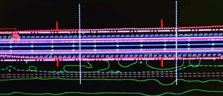
Before the release of MicroStation OpenRoads technology, roadways were designed in three two-dimensional (2D) views. The first view looked down at the roadway from space on a flat Earth. This was done to see how the plan fit the topography and if it could get by things like buildings, rivers, and other obstructions. The second view was from the centerline at the side. This view would allow us to see how the roadway followed the surface of the Earth. The final view, a cross-section perpendicular to the centerline, showed us how the roadway tied to the Earth. Using these three views, we would then have to envision the three-dimensional (3D) model in our minds while making sure to follow governing criteria.
In 3D using MicroStation OpenRoads technology, we still design the road using the three 2D views, but the software then creates a 3D model for viewing. OpenRoads Designer (ORD) also allows us to create a model that has simple inputs. For example, we can change the width of the lanes to any reasonable value, and the entire model will update automatically. This allows us to analyze a roadway in minutes and save ourselves hours of work. The level of detail produced allows us to now model the roadway in a real-world setting, which provides a better analysis of the final product.
Designing Roadside Ditches in MicroStation
In this video, I will show you how I design roadside ditches by changing the shape and slopes of the ditch to fit within the existing right-of-way. This is for a roadway overlay and ditch improvement project — an eight-mile-long Illinois state highway located in Boone County.
Learn more about the transportation services we provide and the people that provide them by visiting our website:


